* Text fwd by Bruce Gagnon on May 7, 2011 with the words that
"Here is a story from our local paper about the conflict over dredging the river at BIW for the Aegis warships. Lots of environmental consequences info that might be useful to you all on Jeju."
_____________________________________
http://www.timesrecord.com/articles/2011/05/06/news/doc4dc414caaa4d7355961617.txt
Kennebec dredging prompts renewed river classification questions
By Seth Koenig, Times Record Staff
Published:
Friday, May 6, 2011 2:09 PM EDT
PHIPPSBURG — Lawmakers, shellfish harvesters, environmentalists, shipbuilders and Navy sailors are among the vast number of stakeholders waiting to see whether a study of the Kennebec River bottom later this month shows sufficient depth for a destroyer to sail away from Bath Iron Works.
Wide-ranging controversy surrounds a proposal by the U.S. Army Corps of Engineers to dredge the channel this August to make way for the departure of the DDG-111 USS Spruance in early September.
Phippsburg clammers and local environmentalists argue that the summer dumping of dredge spoils in the river will devastate area clam flats, while fishing guides and seasonal business owners expressed concerns that the loud, unsightly process will scare away tourists at a time of year crucial for their businesses.
Bath Iron Works and Navy officials counter that the livelihoods of thousands of shipbuilders depend on their ability to keep the channel deep enough for ship departures and that the impacts of the dredging project on the ecosystem will be less severe than opponents claim.
Debate over whether the summer dredging should be allowed — dredging has long been permitted during winter months, when riparian wildlife and businesses are less active — has given way to a larger battle over the official water quality rating of the Kennebec.
Where the debate goes from here hinges, in part, on the outcome of the Army Corps’ proposed hydrographic survey of the river near Doubling Point around May 20. If the buildup of river-bottom sand recently seen as jeopardizing the warship’s departure has been naturally washed away by swells that come with spring runoff, pressure to dredge will lessen.
“The shoaling — especially at Doubling Point — is somewhat unpredictable,” William Kavanaugh, of the Army Corps of Engineers, told The Times Record. “Our plan is to survey the channel around the middle of May to determine to what extent the runoff has affected the shoaling. There is a possibility that the runoff has completely dispersed the shoaling. However, given what we’ve heard about there being a lesser snowpack on the mountains this year, we have to err on the side of caution and proceed as if there is still shoaling that we have to address.”
SA or SB
Members of the Legislature’s Environment and Natural Resources Committee voted this week to table discussion of LD 1398 pending the outcome of the Army Corps’ research.
Included in the language of LD 1398, an omnibus bill proposing a multitude of tweaks to Maine Department of Environmental Protection rules and designations, is what department officials describe as a clarification of the river classification.
Opponents of the move deem it a “reclassification.” The standoff on verbiage is rooted in a disagreement over what state environmental regulators 20 years ago intended when they most recently classified the waters in the area.
Department of Environmental Protection officials say their predecessors intended for the waters of the Kennebec to be Class SB waters, and the language in LD 1398 aims to codify that interpretation.
Representatives of several local groups — including the Friends of Merrymeeting Bay, Kennebec Estuary Land Trust and Phippsburg Shellfish Committee — believe the waters in question have always been the more restrictively regulated Class SA waters, in which the discharge of dredging spoils would be illegal.
“Our position is that what we are doing in LD 1398 is a correction,” Patricia Aho, deputy commissioner of the Department of Environmental Protection, told The Times Record. “We believe that the intent in 1989 and 1990, based on the documentation and testimony we have, was to make the waters in the Popham Beach area SA, and going upriver, SB. And if you look at how the department has been managing the river over the past several years, it’s obvious the department has always considered this area SB.”
Jon Fitzgerald, vice president and general counsel for BIW, agreed, telling The Times Record that the shipyard has done almost annual dredging projects of smaller scales than what’s being proposed at Doubling Point, and state regulators have routinely dealt with the projects as though the waters are Class SB.
Department documents clearly indicate that tidal waters east of longitude 69-degrees-50-minutes-05-seconds west, and west of longitude 69-degrees-47-minutes-00-seconds west — a stretch that spans the ocean face of Popham Beach — are Class SA waters.
The documents do not include latitudinal boundaries for the Class SA patch, however, and if the east-west parameters are extended infinitely in the north-south directions, the encompassed waters would include the Phippsburg side of the Kennebec. Steve Hinchman, an attorney representing the opponents of the August dredging project, said that’s what state officials had in mind when they drafted the documents in 1990.
“(If followed upriver, the SA water boundaries) capture high value clam flats on the western shore of the river, and since that designation was made, those have been cleaned up,” Hinchman said. “Consistent with the SA designation, Phippsburg has gone out and prohibited overboard discharges in these waters. To them, it’s very important. It’s an important piece of maintaining and protecting the natural resource based economy. When you dump in the river, it buries clam flats and lobster traps, and leaves spoils washing up on the shores.”
Bob Cummings, a longtime member of the Phippsburg Shellfish Committee and a former town selectman, recalled the time period in which the water classifications were established by state regulators.
“As a board 20 years ago, selectmen ... strongly urged the upgrading of the river to SA,” Cummings wrote in testimony prepared last month for the Legislature’s Environment and Natural Resources Committee. “Now we are being told, belatedly, that the reclassification was just a mistake, a mistake so heinous that it doesn’t even warrant having the DEP board follow the state law that requires public hearings in or near the communities affected by water classification changes.”
BIW’s Fitzgerald countered that the eastern longitude provided in the 20-year-old documents intersects with a bar of land reaching into the mouth of the river, creating a natural northern boundary and rendering a state latitudinal boundary unnecessary. In documentation describing water classifications elsewhere in the state, Fitzgerald said, the language clearly refers to “tidal waters of the river” when the intention is to include waters upriver as well.
Such a reference is missing regarding the Kennebec, he said. Seemingly undisputed in the debate over LD 1398 is the fact that the Georgetown side of the river flows with waters classified as SB.
“It would be illogical, if not impossible, to manage a river where one side is SA and one side is SB,” Aho said.
To the river go the spoils
The decision before the legislative committee is whether to endorse the omnibus bill as is, cementing the waters in question as Class SB waters, or to pull that issue from the bill and debate it as part of separate legislation.
Hinchman said that even if the Phippsburg side of the Kennebec is ultimately declared to be SB, opponents of the in-river dredging disposal have a legal argument on their side. He said studies show the water quality on both sides of the river to reach SA standards, begging the question of whether the river waters can legally be considered anything less.
Hinchman added that even in Class SB waters, activity deemed detrimental to the environment is prohibited.
“There are valid arguments you can’t dump in class SB waters, and we’re going to make those arguments,” Hinchman said. “There’s nothing good to be gained by this ‘clarification,’ only harm. The time has come to stop dumping dredge spoils in the middle of the river. It keeps the channel open, but it drives out all the other uses, and that’s not fair.”
Even the question of whether dredging is detrimental to the environment is contested.
The proposed August dredging project involves moving 70,000 cubic yards of sediment from spots near Doubling Point and Popham Beach, and depositing the spoils off the shore of Popham Beach at a location known as Jackknife Ledge, as well as in-river at a site along the so-called Kennebec Narrows.
In speaking with The Times Record, Fitzgerald echoed a statement made by the Army Corps’ Kavanaugh at a Feb. 24 public hearing on the dredging project held in Phippsburg, saying that more than 98 percent of the dredging spoils is made up of sand — not the thicker sediment believed to be most detrimental to maturing shellfish populations.
Dredging, said Fitzgerald, has a similar effect on the river water as a heavy rainstorm, which temporarily kicks up sand, but has little longterm effect.
Stephen Dickson, a geologist with the Maine Department of Conservation, wrote in an email to a colleague that disposing of the dredge spoils in-river would likely be favorable to transporting the material offshore or bringing it upland. He wrote that the river-bottom sands following the water flow naturally replenish the sandy Popham Beach at the mouth of the Kennebec.
“Permanent removal of large volumes of sand from portions of the river near Bath could possibly affect Popham Beach in the future,” Dickson wrote, in part. “Disposal of sand within the Kennebec River is certain to avoid and minimize long-term beach impacts.”
Hinchman acknowledged Dickson’s argument, but argued it’s one thing for the sands to be carried to the beach by natural means, and another for humans to recreate the process unnaturally.
“Their idea is that you need to keep the dredge spoils in the river to replenish the beach,” Hinchman said. “But what dredging does is artificially creates those conditions on clean, non-high weather days. You’re essentially taking the normally clean-water month of August and turning it into a particularly nasty and stormy March, according to the water quality conditions. The problem with dredging is it overloads the system. You’re taking one of the cleanest months of the year from a water quality perspective and making it one of the dirtiest.”
Navy perspective
Cmdr. Tate Westbrook, commanding officer of DDG-111, said even if the Army Corps’ hydrographic survey reports that the sand buildup receded, he hopes the dredging project will continue on as planned.
He said even sailed away as light as possible, the destroyer will need 29 feet of water depth to get out of the river. Without the troublesome shoaling observed recently at Doubling Point, Westbrook said the channel there has an average depth of about 27 feet. The highest of high tides adds between six or seven feet, which allows Navy warships to pass.
“Until I see a dredge in the river at that spot, I will continue to be concerned,” Westbrook said.
When the DDG-111 navigated out to the Atlantic Ocean on a previous occasion for sea trials, Westbrook said ship operators observed a sonar depth between the bottom of the 9,000-ton destroyer and the river floor to be two feet. That’s way too close for comfort, he said.
“I would characterize the Kennebec River transit as one of the most challenging navigation details one would be asked to do in the Navy,” Westbrook told The Times Record. “Compared to other transits going into foreign or domestic ports or Navy ports around the world, the twists and turns make it already one of the most challenging navigation details we might face.
“The concern is that anything shallower than 29 feet, and we’ll touch bottom,” he continued. “Touching bottom is bad. I’m the captain of a $1 billion asset, and I’m in charge of 275 sailors’ lives, and safely getting the ship down the river and protecting the environment is first and foremost in my mind.”
Westbrook described himself as an “environmentalist” and acknowledged that “the last thing I want to do is mess up somebody’s fishery.”
But he said rolling the dice with shallow water — or by navigating the ship in deeper waters to the east of the federally designated channel, but closer to the shore, as some have suggested — risks an even greater environmental disaster than the dredging project is claimed to be.
“The one thing that hasn’t been discussed is a situation where I’m steaming down the river in my ship in a nonstandard, abnormal and high risk (condition), and I’m transiting that much closer to a rock bottom,” Westbrook said. “If, God forbid, I happen to touch bottom not on a soft sandy spot, but a sharp granite spot, and that rips open the hull plating of my ship, it’s no longer just speculation about the environmental impact. Who knows what the public impression would be if 500 gallons, 1,000 gallons or 10,000 gallons of fuel are discharged into the river following a grounding?”
Solutions?
While all eyes will be on the Army Corps’ hydrographic survey later this month, the battle over the designated water classification of the Kennebec River, and whether the disposal of in-river dredge spoils should ever be allowed again, will likely press on regardless of the results.
The urgency with which that battle is waged may be lessened if the Army Corps decides the proposed August dredging is not needed.
Ed Friedman, president of the Friends of Merrymeeting Bay, hopes the question of whether the eastern Kennebec is Class SA or SB can be discussed without the looming deadline of an August dredge.
“We are not here to argue against dredging, but to suggest all parties could have their objectives met through a series of project changes to be made outside of this legislation and without the proposed (classification) downgrade,” he wrote in testimony submitted to the Natural Resources Committee.
Among the variables at play are the levels at which the dredging takes place — could an amount less than 70,000 cubic yards, but enough to get the DDG-111 through, be removed, Friedman pondered recently — and where the spoils are dumped. Hinchman suggested using an approved dredge disposal site off the coast of Portland in the immediate future to avoid any damage to clam flats and lobster traps.
For the Army Corps and BIW, the costs associated with either of the two suggestions are problematic.
Kavanaugh told attendees of the Feb. 24 public hearing that it’s not cost-effective for the Army Corps to move the dredging equipment to Maine for multiple small dredging jobs, compared to one project which will deepen the channel for several years. The last time the Army Corps dredged near Doubling Point was 2003, he said.
Fitzgerald said that to transport dredging spoils to a location off the coast of Portland during the shipyard’s regular, smaller scale dredges would increase the costs of the projects “five- or sixfold.”
“For the Army Corps, they don’t have a lot of money to come dredge, so they want to come up and do five to seven years’ worth of dredging at once,” Hinchman said. “Well, you can’t do that to these people in August. Now is not the time to overdredge. There has to be a solution that allows for the rest of the uses of the river to continue with the least amount of impact.”
skoenig@timesrecord.com
Copyright © 2011 - Times Record
_____________________
Bruce K. Gagnon
Coordinator
Global Network Against Weapons & Nuclear Power in Space
PO Box 652
Brunswick, ME 04011
(207) 443-9502
globalnet@mindspring.com
www.space4peace.org
http://space4peace.blogspot.com/ (blog)
Thank God men cannot fly, and lay waste the sky as well as the earth. ~Henry David Thoreau
Showing posts with label BIW. Show all posts
Showing posts with label BIW. Show all posts
Sunday, May 8, 2011

Saturday, May 7, 2011
Text Fwd:[Translation] WHAT DO THESE SHIPS DO? 이 배들은 무엇을 하는가?
The below is the Korean translations of the links. Click the links to see the articles in the original English language version.

5월 7일 배쓰 철강 공장(Bath Iron Works: BIW) 에서 또 하나의 [건조된] 이지스 구축함이 “세례식”을 받을 것입니다. 양교수님이 이지스 구축함들을 정박할 남한 제주도의 해군 기지 건설에 항의하며 단식 30일째 김옥에 있습니다.
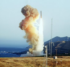
 레이시온이 지은 “미사일 방어”의 요격 미사일이 이지스 구축함으로부터 발사되고 있습니다.
______________________________
http://space4peace.blogspot.com/2011/05/what-do-these-ships-do.html
2011년 5월 5일
이 배들은 무엇을 하는가?
브루스 개그논
저는 오는 6월 17일부터 19일까지 메사추세츠 근처에서 열릴 글로벌 넷워크의 19번째 연간 우주 조직 회담에 관련된 제일들의 제 속도에 박차를 가하고 있습니다. 우리는 행사에서 레이시온 회사의 우주 기술 작업에 초점을 맞출 것인데 그것들이메사추세츠에 기반하고 최근 가장 불안정하게 하는 무기 시스템들중 많은 것들을 바로 우리 눈앞에서 짓고 있기 때문입니다.
우연히, 오는 토요일 메인주 베쓰에서 여러분께서 위의 사진에서 보듯 스탠다드 3 (SM3) 미사일 방어” 요격기의 발사대인또다른 이지스 구축함의 건조, “세례식”이 있을 것입니다. 그러므로 이 두 행사가 요즈음 제 일을 묶고 있습니다.
메인주에서 이 이지스 전함들이 정말 무엇을 하는지 아는 사람은 별로 없습니다. 사람들은 케네디 강으로 차를 몰고 가 배쓰 철강공장 밑 선박장에 보통 정박해 있는 1~2 개의 이지스들을 볼 때야 그것들을 주목할 지 모릅니다. 사람들은 배쓰 철강 공장이국가에서 가장 큰 비정부 고용주이며 배쓰가 선박 건조의 긴 역사를 갖고 있다는 것을 압니다. 그러나 그것으로 끝납니다.대부분의 사람들은 그 배들이 미국(누구로부터?)을 방어한다고 생각하고 놔둡니다, 사실, 대부분의 메인주 사람들은 그 것 이상을알려고 원하지 않는데 왜냐하면 배쓰 철강 공장에서 일할 지 모르는 이웃들과 갈등에 있고 싶어하질 않기 때문입니다.
몇년전에 환경 운동에 유행처럼 “생물 지역” 이란 문구가 있었습니다. 그 생각은 좋은 환경 운동론자는 그것들과 일을 지키기위해 생물 보전에 대해 더 친숙해야 한다는 것입니다. 그러나 저는 그 말이 다른 운동들에도 적용되어야 한다 봅니다. 우리는모두 미군사 제국이 우리의 생태-지역에서 일하고 있는지 알고 그것이 우리의 국가와 세계에 좋은 일인가에 대한 대중 토론을북돋아야 합니다.
레이시온에 위해 만들어지는 이지스 구축함들과 요격기들 경우, 이 시스템들은 오늘날 미 국방부에 위해 배치되는 가장 도발적인무기들입니다. 제가 과거에 많이 묘사한 것처럼, 그것들은 러시아와 중국의 경계를 따라 찔러지며 그 양쪽의 국가들의 대항움직임을 강요하고 잇습니다. 이는 우리를 위험하고 비싼 새로운 무기 경쟁으로 이끕니다.
우리 주가 재정적 위기에 있음을 보임에 따라 여기 메인주에서 우리는 깊은 큰 구멍들이 있는 도로들 위에서 차를 몰며 우리의많은 다리들은 수선을 필요로 하며 교육 및 사회 프로그램들은 삭감됩니다. 진보적 활동가들은 경탄스럽게도 이 삭감들에 항의하나미국 군사 지출에 대한 치명적 연결을 하는 이들은 많지 않습니다-그리고 그들은 우리의 셍태 지역의 군사 생산 장소들에 대한거대한 돈의 지출을 특별히 무시합니다.
이 글을 쓰는 와중에 양윤모 교수는 남한 제주도의 감옥에서 30째 단식일을 보내고 있습니다. 그의 신성한 생태-지역 파괴에대한 비폭력적 저항으로 인한 수감은 메인주 철강 공장과 메사추세츠 레이시온에 직접적으로 연결되어 있습니다.
우리의 생태 지역들 각각을 연결하는 하나의 원이 있으니 그것은 안타깝게도 폭력과 파괴의 하나입니다. 이지스 구축함들은 오늘날리비아, 제주도, 그리고 메사추세츠와 메인주에서 새로운 10억 달러 전함들을 지불하기 위해 사회 진보 생명을 파괴하고 있으며우리 모두를 위해 미래를 불안전하게 만들 것입니다.
관련 링크: 우주의 무기와 핵을 반대하는 글로벌 넷워크 19번째 연간 우주 조직 회담, 메사추세츠, 안도버
http://www.space4peace.org/actions/gnconf_2011.htm
_________________________________________________
http://space4peace.blogspot.com/2011/04/protest-of-aegis-christening-planned-in.html

그 들 나라의 “미사일 방어” 시스템들로 장착된 이지스 구축함들 정박에 항의하는 일본 활동가들 미국 해군의 이지스 구축함들을 정박하는데 사용될 환경적으로 민감한 섬의 해군 기지건설에 항의하는 제주도의 한국인들
http://space4peace.blogspot.com/2011/04/protest-of-aegis-christening-planned-in.html
2011년 4월 26일
메인주에서 계획된 이지스 "세례식" 항의 시위
브루스 개그논
[미] 해군은 5월 7일 토요일, 메인주 배쓰 아이런 웍쓰에서 또다른 구축함을 “세례” 할 것이다. 평화 단체들은 오전 8시30분 부터 10시까지 그 행사에서 항의 시위를 벌일 계획이다. 시위 후에 사람들은 배쓰의 아담스 멜만 하우스(센터 스트리트212)의 정오 점심에 오도록 초청된다.
시위는 미소하는 나무들의 비무장 농장, 우주의 무기와 핵을 반대하는 글로벌 넷워크, 메인주 평화 재향 군인회, 그리고 메인주코드 핑크에 의해 후원된다.
“미사일 방어” 시스템들이라 불리는 것들로 장착될 이 구축함들은 핵 보복 군사력을 무력화하기 위해 러시아와 중국 경계들 주위에이지스 배치를 부르는 공격적 미 국방부 군사 전략의 열쇠들이다.
남한 제주도에서 현재 해군 기지 건설에 반대하여 진행되는 힘들게 싸워지는 투쟁들은 해군이 이 배들의 증가하는 함대를 위해 더많은 항구들을 필요로 함에 따라 이 이지스 구축함들에 연결되어 있다.
120만 달러가 지출되는 리비아에 대한 개개의 크루즈 미사일 공격들은 이 이지스 전함들에 의해 발사되었다.
연구들은 군사 생산에 십억 달러를 소비하는 것은 8,555개의 직장들을 창조한다 한다. 그러나 같은 10억 달러가 BIW 와같은 철도 시스템들을 짓는데 투자되면 19,795개의 직장들을 얻을 것이다.
대중은 오늘날 직장으로 아우성 치고 있다. 기업들은 더 싼 해외의 노동에 끌리기 때문에 거대한 세금 삭감에도 불구, 이곳미국에 투자하고 있지 않다. 그러므로 우리가 이 나라에서 더 많은 직장을 원하면 우리는 현재 끝없는 전쟁에 낭비되는 연방 세금달러들을 취하고 BIW 와 같은 시설들에 철도 시스템들, 풍력 터빈들, 그리고 태양력 시스템들을 짓는데 투자해야 한다.
더 많은 정보는 (207) 763-4062 or (207) 443-9502에 연락하시길.
Subscribe to:
Posts (Atom)

![[URGENT PLEA: In Update] EMERGENCY in GANGJEONG Since AUG. 24, 2011](https://blogger.googleusercontent.com/img/b/R29vZ2xl/AVvXsEiQvpaNf6EePZVucu97_JphYsFS5IgumnSiA4YAmen1PZcim6vMmW7XjZ7J6nLh-Cu36mwBN5n1evrA3ey0vYMpwlAGsgnSFggv6a1w4Qx9BvvqOB0hy0BIcBkL2Exfs3zIxBsBuDGa1kzg/s227/jejusit.jpg)


![[Solidarity from Japan for the Jeju] 253 individuals and 16 groups/organizations](https://blogger.googleusercontent.com/img/b/R29vZ2xl/AVvXsEivji7100kBkr0hzvqYfh4IBBilkZ6XgDIg89jOxS6kTssxsVKC6Wm-fZbKOEsiy3zcO-9gW6GHspD5R_2C9WsGx5S1Z5VPj_OVRF7H6dxdaT0S-2H1eqsDsYvIwOV26VscxTHnKmP5iZmh/s227/jeju_12_10j.jpg)

![[Translation] Korean organizations' statement: Immediately cancel the joint ROK-US drill Nov 26](https://blogger.googleusercontent.com/img/b/R29vZ2xl/AVvXsEgfKDMo-qyEjm5asUtHlREyJY_5Ou-2tyB8SH6aUxiViRbbKR-8W_rirFiGp5DYSoD_KaeNOPMWR0af0ZPUIbJKmR89ImDvADHsGAIqsJVBvJNBEIl5wLd3G_zhPDW3Z2SxsHXadOsXe8st/s227/1.jpg)
![HOT! [Hankyoreh Hani TV] Beneath the Surface: the investigation into the sinking of the Cheonan](https://blogger.googleusercontent.com/img/b/R29vZ2xl/AVvXsEh80rL3Qv9GnfHSqbYMfivdqX5gZN-1O_VQj3A_Gk3yjWdybHwJCsprA3l6cEQB0cYCP2oNeaLo2ohLGIy0Uqqkv_fRkBevGJ2f-qkKD5eP1ZGsKeQ-r-jHUUb79WvucIN7hpEtXza4xXCL/s227/HaniTV+Cheonan.gif)


![[Translation]Statement against illegal inspection and unjust lay-off by the Kunsan USAFK!(Nov_2010)](https://blogger.googleusercontent.com/img/b/R29vZ2xl/AVvXsEg3JlQ-lreusCIJo5Yv2e3ZrRwrSMUE7UQxlrDVjmBehl0Pa24QZIAbZ5vUpgnnExbkKL9PdCwxVYSHWJkr_XK0FM4EhU3CMFhqfborVNu_p4v3bEFpNm3ia-aEHnvMMuEBI27aB7_BETuJ/s227/gunsan+protest.gif)
![[Translation] Korean organizations' statement against dispatching special force to the UAE on Nov.](https://blogger.googleusercontent.com/img/b/R29vZ2xl/AVvXsEiU7TNhTDLLwZkKP0Z78JsCZKp6je-QSFll3_ThmLES_y_nPLXEzeakrsZXoNxhN5blopEhy6xGV2tneJrniPdTR-JvOQMmSLr_HhlucxFvbusxk4oKvvMO2laBOHSIkB9OOeOxrQlqCA0O/s227/antiwarpeace.jpg)
![[Translation] Stop, Joining MD!: South Korean activists' statement and writing on Oct. 25, 2010](https://blogger.googleusercontent.com/img/b/R29vZ2xl/AVvXsEggGIHVei8j7LCJPJB5HIrspd942q436daNTquP-pFd45Cl70Ml_1JFiFDHgKu6FcoqNgFVKIFqjeuSPau2k_BwGHhx0cqFFL2-4ybZSTlmua0_AsERBtKYQa7jZk7uNj41LX6rj2vksHbo/s227/StopMD.jpg)
![[In Update] People First, NO G-20 (Nov. 6 to 12, Korea)](https://blogger.googleusercontent.com/img/b/R29vZ2xl/AVvXsEhZl8VTqeL7o2ndliGIE-sZFCikbTgfB9KCc3AtZvDaYijBBEhdfultMEOpyrCaD5gzpH8mqfWjU20KXMbSUl-5KM7yQeHU6z3BWV8tiOy4UKaCudz9VKWoi5x58xdC_gQpJTjkR5u7O9xf/s227/left21_G20.jpg)
![[International Petition] Stop US helipad plan in Okinawa to save great nature](https://blogger.googleusercontent.com/img/b/R29vZ2xl/AVvXsEihgYmdb0N8ViPvTFC_5i-Psbt4eX_LnAUEOtZkUngv_pGvRyWag1r6W60NicLLyTgWq-sPT1hBxLY5SadEIVv5McfZQ5uIhe-W0VoflQNqojsYZjFW6AH-gB1jsmSDGnGuKIFk2UkvNbFG/s227/yanbaru_w.jpg)
![[Global Network] against the first launch of Quasi-Zenith Satellite, Japan, on Sept. 11, 2010](https://blogger.googleusercontent.com/img/b/R29vZ2xl/AVvXsEj2sYpfodDDMIA7qXwuda0DmKapxXFB479fDnn8RKy7QNZqz0VEvWucNd-DleZ37hWNXC-Z8QtaqtM37VuPwac5SgclJ9_khBBSWOedvm19MRXIP1j1kcWrK6EW5IFjQdEEY2h7E6xuyNvC/s227/Qzss-45-0_09.jpg)
![[In update] Some collections on the Koreans’ protests against the sanction & war on Iran](http://4.bp.blogspot.com/_gnM5QlRx-4c/TJMvke6t8zI/AAAAAAAAFO4/tamQ8LUnOOA/S227/No+Sanction+on+Iran.jpg)
![[Three International Petitions] to End the Korean war and peace treaty(or peace resolution)](https://blogger.googleusercontent.com/img/b/R29vZ2xl/AVvXsEhlohLVYtpCg7iMsZhNYY4hBbhTi2dIheHMHWLDph9X2y78cjgZV1LeSfUJeu80elhJm70Q9E059q72lK-spSPvsRG4bPuCDIytltJB9IH3mWt9OG98HqhnTsPakwhvNeoCFUgF1xoxQ2EZ/s227/border.jpg)


![[Collection of Documents] No Base Learning and Solidarity Program_Korea(June 14 to 20, 2010)](https://blogger.googleusercontent.com/img/b/R29vZ2xl/AVvXsEix_HzjToh3nNGHBc-_5gasq-ykcaZ6GInLixILmZVyRJ5xoeHCxWOyYd9fSM7bmnuFsjSrYOGEPnQOwB1Dcyo-sN4Pw0cFPhUtKig_qlVnGL1Wi82ClvPqbEPWYhJiqdNF0DyzLIBETMB9/s227/No-Base-banner.jpg)
![Site Fwd:[John Hines] A U.S. Debate coach’s research trip on the Issues of Korea](https://blogger.googleusercontent.com/img/b/R29vZ2xl/AVvXsEg8yRra0zNhKHN74Auqhd3Nx9tZ7BWCGflRJHGH4CfzBT_yjhZ8Nl9b3OZuLpYWJ2exsjmR0oVl-Qq_cf832p2VdmOZhUi-lCFzCNeDSyVtweX1lWZPC-RlHmDMLtilHwHjNFTenBiM4Fk4/s227/Jeju-Peace-Tour.jpg)


![[News Update] Struggle Against the Jeju Naval Base since Jan. 18, 2010](https://blogger.googleusercontent.com/img/b/R29vZ2xl/AVvXsEhKfSTRC5QKBBSFIq_m7QIqXdlbL4-gF5GJYn9Q-pN__k7sV7uxGDcLY5L8xmU7QuWuUhBT_GhG-URBPO80RT3AfWfDrWJr06h1hFuZC6ZBVKe4U6PS1Cd7Kr6olO8TYQtk13Drox7IS6ea/s226/scrum1.jpg)


![[Urgent] Please spread the Letter!: There was no Explosion! There was no Torpedo! (May 26, 2010)](https://blogger.googleusercontent.com/img/b/R29vZ2xl/AVvXsEhSd2yWZ3xGwnJQXB73z5FgXCqSosAoB9_33-GLYprOmLqjmvgSAQp1BYI7e4slK1FDxHRi9KK4um-OpDaj8QOkXwAScVAgvvq6-ehbDA-hbkr96wT9oHNNmWnBPv8GU4hoZp9X8F9AZBX4/s227/grounded.jpg)
![Text Fwd: [Stephen Gowans]The sinking of the Cheonan: Another Gulf of Tonkin incident](https://blogger.googleusercontent.com/img/b/R29vZ2xl/AVvXsEi_L6hB3RZ1MovTXHe0A8yn_RfgMALGR0kM6poBuGp809xwvHtB_-PGWtS_WpyPWatyd9lB2pPqL2gOLc4dTCEdJ9sMvxJWEdapl-mMLm7WHAsV-jVpgqarVh8XBtdz_0c-Vohdh3HtJahD/s227/lee-myung-bak.jpg)
![[Japan Focus]Politics in Command: The "International" Investigation into the Sinking of the Cheonan](https://blogger.googleusercontent.com/img/b/R29vZ2xl/AVvXsEiHmTo8v-uCJnabRhMdnBAkC9J3s5bb2JsDKiT5leJHwbK8IDJHxfJmqQ_C0Is_bPC6UGMf05CA0exF2y4r2x9RhFUHT0kjsKviaME_MZXKnq775UyYAdb7w2SAzE75XvBfHp1al2q6i3cf/s227/wen_jiabao_and_lee_myungbak.png)
![[Japan Focus] Who Sank the SK Warship Cheonan? A New Stage in the US-Korean War and US-China](https://blogger.googleusercontent.com/img/b/R29vZ2xl/AVvXsEiKSS5ULT5QBaMGYpXXqBMX9jtwLwMLuK469b6Ku72GTJYKUObzTANaPjZqvvpPzYMJgPF53sjhvhK3DVa88ipYlggsJageykXlkxY6s8TW05xcU-_vfhf-pACUoaWuFbT-fsU1qEhm_yIi/s227/buoy_map.gif)
![[Updated on 12/13/10] [Translation Project] Overseas Proofs on the Damages by the Military Bases](https://blogger.googleusercontent.com/img/b/R29vZ2xl/AVvXsEikADE6JovUNspQyZUWVMTLAQg7yQNqXpVUbqZPk8f4uc_1723_xm1Cco6WAmstQXVPnaJAcb1mZA8Ny_3xONT_f5uh8MNLPnUhtqdGgy3HCtC1Vbbz4Q0ZY1Cssu-4cJEVNdrvznbS5UzO/s227/missile.jpg)
![[International Petition] Close the Bases in Okinawa](https://blogger.googleusercontent.com/img/b/R29vZ2xl/AVvXsEhNpQiHklwFbWVlFK7GDFXnBSOOSFEj3Il-We-N3uTDldKiidL2NGZs7X_LtTnatzTo_r8CexRkFe8NhfxYqmgp1knEEslROTfNjI5_mSb57cdbhPkftvanveYBaevAD9xuKDGoIxiTwoSb/s227/2.jpg)

![[In Update]Blog Collection: No Korean Troops in Afghanistan](https://blogger.googleusercontent.com/img/b/R29vZ2xl/AVvXsEjjEmCRXSNAG7_QBxKWbdksmxoWR4nyAovQTTdR1G2AuXh0jxtqNkI9OmYgYWRoLAJShvtBvE840QXuBWSVh3u3zMYqkNAFX6OWy3m5Nur4HM7uNK-pKT1ycyApJp-VLyhIFRRcoisYAh0E/s226/No-Troops-to--Afghanistan.jpg)


