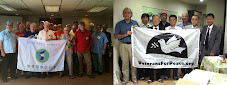
 * Text forwarded from Steve Zeltzer on Jan. 17, 2011
Korea Policy Institute
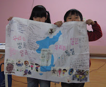
What's Happening on the Korean Peninsula?
Marty Hart-Landsberg* January 14, 2011
What's happening on the Korean peninsula? If you read the press or listen to the talking heads, your best guess would be that an insane North Korean regime is willing to risk war to manage its own internal political tensions. This conclusion would be hard to avoid because the media rarely provide any historical context or alternative explanations for North Korean actions.
For example, much has been said about the March 2010 (alleged) North Korean torpedo attack on the Cheonan (a South Korean naval vessel) near Baengnyeong Island, and the November 2010 North Korean artillery attack on Yeonpyeong Island (which houses a South Korean military base).
The conventional wisdom is that both attacks were motivated by North Korean elite efforts to smooth the leadership transition underway in their country. The take away: North Korea is an out-of-control country, definitely not to be trusted or engaged in negotiations.
But is that an adequate explanation for these events? Before examining the facts surrounding them, let's introduce a bit of history. Take a look at the map above, which includes both Baengnyeong and Yeonpyeong Islands.
The armistice that ended the Korean War fighting established the Demilitarized Zone (DMZ) which separates North Korea from South Korea. At that time, the U.S. government unilaterally established another dividing line, one intended to create a sea border between the two Koreas. That border is illustrated on the map by line A, the blue Northern Limit Line (NLL).
As you can see, instead of extending the DMZ westward into the sea, the U.S. line runs northward, limiting North Korea's sea access. The line was drawn this way for two reasons: First, when the fighting stopped, South Korean forces were in control of the islands off the North Korean coast and the U.S. wanted to secure their position. Second, control over those islands enhanced the ability of U.S. forces to monitor and maintain military pressure on North Korea.
North Korea never accepted the NLL. It argued for an alternative border, illustrated by line B, the red West Sea Military Demarcation Line (MDL). Acknowledging the reality of Southern forces on the islands off its coast, North Korea sought recognition for a sea border that went around the islands but otherwise divided the sea by extending the DMZ line.
North Korea never accepted the NLL. It argued for an alternative border, illustrated by line B, the red West Sea Military Demarcation Line (MDL). Acknowledging the reality of Southern forces on the islands off its coast, North Korea sought recognition for a sea border that went around the islands but otherwise divided the sea by extending the DMZ line.
![[URGENT PLEA: In Update] EMERGENCY in GANGJEONG Since AUG. 24, 2011](http://2.bp.blogspot.com/-3iz8k-USXVY/TlmRYhhIYtI/AAAAAAAAL2c/9dbF85ZIkIs/s227/jejusit.jpg)

![[Solidarity from Japan for the Jeju] 253 individuals and 16 groups/organizations](http://2.bp.blogspot.com/_gnM5QlRx-4c/TR_YeNVE1yI/AAAAAAAAHWQ/ARyf6oQN0S0/S227/jeju_12_10j.jpg)

![[Translation] Korean organizations' statement: Immediately cancel the joint ROK-US drill Nov 26](http://2.bp.blogspot.com/_gnM5QlRx-4c/TPOE8VKXHFI/AAAAAAAAGlM/8lryt-8sFjc/S227/1.jpg)
![HOT! [Hankyoreh Hani TV] Beneath the Surface: the investigation into the sinking of the Cheonan](http://4.bp.blogspot.com/_gnM5QlRx-4c/TOI83qht8aI/AAAAAAAAGXU/22SW6Q5ntV8/S227/HaniTV%2BCheonan.gif)

![[Translation]Statement against illegal inspection and unjust lay-off by the Kunsan USAFK!(Nov_2010)](http://4.bp.blogspot.com/_gnM5QlRx-4c/TOPLsVkZMqI/AAAAAAAAGZs/3YnnckIyAaY/S227/gunsan%2Bprotest.gif)
![[Translation] Korean organizations' statement against dispatching special force to the UAE on Nov.](http://4.bp.blogspot.com/_gnM5QlRx-4c/TOP95zHXlCI/AAAAAAAAGak/E0Ug1XtUFfM/S227/antiwarpeace.jpg)
![[Translation] Stop, Joining MD!: South Korean activists' statement and writing on Oct. 25, 2010](http://3.bp.blogspot.com/_gnM5QlRx-4c/TOP7Es4_2sI/AAAAAAAAGac/eWVMPD-U4p0/S227/StopMD.jpg)
![[In Update] People First, NO G-20 (Nov. 6 to 12, Korea)](http://2.bp.blogspot.com/_gnM5QlRx-4c/TJd53XBzHlI/AAAAAAAAFQo/ldO9JPE3eqo/S227/left21_G20.jpg)
![[International Petition] Stop US helipad plan in Okinawa to save great nature](http://4.bp.blogspot.com/_gnM5QlRx-4c/TKC2AHRNzBI/AAAAAAAAFUo/yGWXODTw_uM/S227/yanbaru_w.jpg)
![[Global Network] against the first launch of Quasi-Zenith Satellite, Japan, on Sept. 11, 2010](http://4.bp.blogspot.com/_gnM5QlRx-4c/TIowa1boy4I/AAAAAAAAFDI/82rAi98uq-c/S227/Qzss-45-0_09.jpg)
![[In update] Some collections on the Koreans’ protests against the sanction & war on Iran](http://4.bp.blogspot.com/_gnM5QlRx-4c/TJMvke6t8zI/AAAAAAAAFO4/tamQ8LUnOOA/S227/No+Sanction+on+Iran.jpg)
![[Three International Petitions] to End the Korean war and peace treaty(or peace resolution)](http://1.bp.blogspot.com/_gnM5QlRx-4c/THef7bzWxYI/AAAAAAAAE44/wwdzSDfYhdw/S227/border.jpg)

![[Collection of Documents] No Base Learning and Solidarity Program_Korea(June 14 to 20, 2010)](http://1.bp.blogspot.com/_gnM5QlRx-4c/TCTvVuN8NeI/AAAAAAAAEek/8vBJVaHdk10/S227/No-Base-banner.jpg)
![Site Fwd:[John Hines] A U.S. Debate coach’s research trip on the Issues of Korea](http://3.bp.blogspot.com/_gnM5QlRx-4c/TINCO36mzzI/AAAAAAAAE_w/Rds12NcBOXM/S227/Jeju-Peace-Tour.jpg)


![[News Update] Struggle Against the Jeju Naval Base since Jan. 18, 2010](http://1.bp.blogspot.com/_gnM5QlRx-4c/S1vvWaP25uI/AAAAAAAACkg/QvpW1tgOlKM/S226/scrum1.jpg)

![[Urgent] Please spread the Letter!: There was no Explosion! There was no Torpedo! (May 26, 2010)](http://4.bp.blogspot.com/_gnM5QlRx-4c/S_9JmsKEU7I/AAAAAAAAEP8/sAWjSPqxzUI/S227/grounded.jpg)
![Text Fwd: [Stephen Gowans]The sinking of the Cheonan: Another Gulf of Tonkin incident](http://1.bp.blogspot.com/_gnM5QlRx-4c/TAL_FtYKQ-I/AAAAAAAAERE/NEEMijiEcRM/S227/lee-myung-bak.jpg)
![[Japan Focus]Politics in Command: The "International" Investigation into the Sinking of the Cheonan](http://1.bp.blogspot.com/_gnM5QlRx-4c/TBMJ2syJzyI/AAAAAAAAEZU/uTYZccU5vyk/S227/wen_jiabao_and_lee_myungbak.png)
![[Japan Focus] Who Sank the SK Warship Cheonan? A New Stage in the US-Korean War and US-China](http://2.bp.blogspot.com/_gnM5QlRx-4c/S_iQ2vE5ZpI/AAAAAAAAEOU/Oo1SPcAe8FE/S227/buoy_map.gif)
![[Updated on 12/13/10] [Translation Project] Overseas Proofs on the Damages by the Military Bases](http://4.bp.blogspot.com/_gnM5QlRx-4c/S-qSj59gPLI/AAAAAAAAEGM/mwjlFtPE-jo/S227/missile.jpg)
![[International Petition] Close the Bases in Okinawa](http://3.bp.blogspot.com/_gnM5QlRx-4c/S8-z3DYNwNI/AAAAAAAADo4/OswTSchK09M/S227/2.jpg)
![[In Update]Blog Collection: No Korean Troops in Afghanistan](http://4.bp.blogspot.com/_gnM5QlRx-4c/SwnlLD9IewI/AAAAAAAAB9E/oUPssnpNidA/S226/No-Troops-to--Afghanistan.jpg)


No comments:
Post a Comment